Kingdom of Anuradhapura
After ruling the country for over 1,400 years, the Kingdom of Anuradhapura fell in 1017 to the Chola King RajaRaja and his son Rajendra, who took King Mahinda V as a captive to India where he died in 1029. The Cholas shifted the capital to Polonnaruwa and ruled Sri Lanka for 53 years. Polonnaruwa was named as The Anuradhapura Kingdom (Sinhala: අනුරාධපුර රාජධානිය, translit: Anurādhapura Rājadhāniya, Tamil: அனுராதபுர இராச்சியம்), named for its capital city, was the first established kingdom in ancient Sri Lanka and Sinhalese people. Founded by King Pandukabhaya in 377 BC, the kingdom's authority extended throughout the country, although several independent areas emerged from time to time, which grew more numerous towards the end of the kingdom. Nonetheless, the king of Anuradhapura was seen as the supreme ruler of the country throughout the Anuradhapura period. Buddhism played a strong role in the Anuradhapura period, influencing its culture, laws, and methods of governance. Society and culture were revolutionized when the faith was introduced during the reign of King Devanampiya Tissa; this cultural change was further strengthened by the arrival of the Tooth Relic of the Buddha in Sri Lanka and the patronage extended by her rulers.
Invasions from South India were a constant threat throughout the Anuradhapura period. Rulers such as Dutthagamani, Valagamba, and Dhatusena are noted for defeating the South Indians and regaining control of the kingdom. Other rulers who are notable for military achievements include Gajabahu I, who launched an invasion against the invaders, and Sena II, who sent his armies to assist a Pandyan prince.
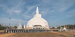
Because the kingdom was largely based on agriculture, the construction of irrigation works was a major achievement of the Anuradhapura Kingdom, ensuring water supply in the dry zone and helping the country grow mostly self-sufficient. Several kings, most notably Vasabha and Mahasena, built large reservoirs and canals, which created a vast and complex irrigation network in the Rajarata area throughout the Anuradhapura period. These constructions are an indication of the advanced technical and engineering skills used to create them. The famous paintings and structures at Sigiriya; the Ruwanwelisaya, Jetavana stupas, and other large stupas; large buildings like the Lovamahapaya; and religious works (like the numerous Buddha statues) are landmarks demonstrating the Anuradhapura period's advancement in sculpting.
Kingdom of Polonnaruwa
The Kingdom of Polonnaruwa was the Sri Lankan kingdom from which Sinhalese kings ruled the island from 1055 until 1232. Pollonnaruwa was the second administrative center of Rajarata.
Jananathapuram by the Cholas. King Vijayabahu I eventually defeated the Cholas and re-established the Sinhalese lineage. Polonnaruwa had previously been an important settlement in the country, as it commanded the crossings of the Mahaweli Ganga towards Anuradhapura.
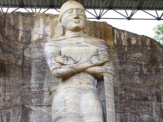
Some of the rulers of Polonnaruwa include Vijayabahu I and Parakramabahu I (Parakramabahu the Great). Most of Polonnaruwa that remains today dates from after the 1150s, as the extensive civil wars that preceded Parakramabahu's accession to the throne devastated the city. Parakrama Pandyan II from Pandyan Kingdom invaded the Kingdom of Polonnaruwa in the thirteenth century and ruled from 1212 to 1215 CE. He was succeeded by Kalinga Magha the founder of the Jaffna kingdom. Kalinga Magha ruled 21 years until he was expelled from Polonnaruwa in 1236.
Yala National Park
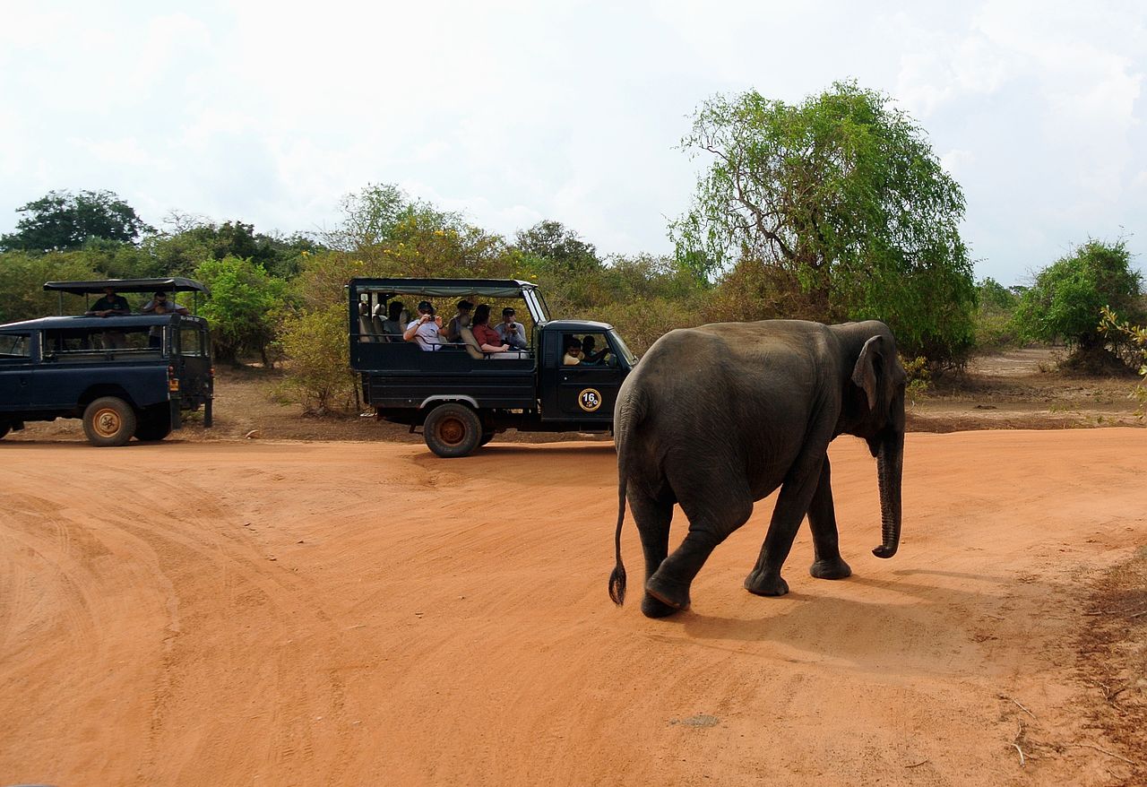
Yala (යාල) National Park is the most visited and second largest national park in Sri Lanka, bordering the Indian Ocean. The park consists of five blocks, two of which are now open to the public, and also adjoining parks. The blocks have individual names such as, Ruhuna National Park (Block 1), and Kumana National Park or 'Yala East' for the adjoining area. It is situated in the southeast region of the country, and lies in Southern Province and Uva Province. The park covers 979 square kilometres (378 sq mi) and is located about 300 kilometres (190 mi) from Colombo. Yala was designated as a wildlife sanctuary in 1900, and, along with Wilpattu was one of the first two national parks in Sri Lanka, having been designated in 1938. The park is best known for its variety of wild animals. It is important for the conservation of Sri Lankan elephants, Sri Lankan leopards and aquatic birds.
There are six national parks and three wildlife sanctuaries in the vicinity of Yala. Among the largest is Lunugamvehera National Park. The park is situated in the dry semi-arid climatic region and rain is received mainly during the northeast monsoon. Yala hosts a variety of ecosystems ranging from moist monsoon forests to freshwater and marine wetlands. It is one of the 70 Important Bird Areas (IBAs) in Sri Lanka. Yala harbours 215 bird species including six endemic species of Sri Lanka. The number of mammals that has been recorded from the park is 44, and it has one of the highest leopard densities in the world.
The area around Yala has hosted several ancient civilizations. Two important pilgrim sites, Sithulpahuwa and Magul Vihara, are situated within the park. The 2004 Indian Ocean tsunami caused severe damage on the Yala National Park and 250 people died in its vicinity. The number of visitors has been on the rise since 2009, after the security situation in the park improved.
Kumana National Park
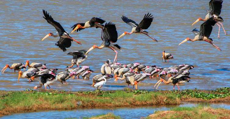
Kumana National Park in Sri Lanka is renowned for its avifauna, particularly its large flocks of migratory waterfowl and wading birds. The park is 391 kilometres (243 mi) southeast of Colombo on Sri Lanka's southeastern coast. Kumana is contiguous with Yala National Park. Kumana was formerly known as Yala East National Park, but changed to its present name on 5 September 2006.
Kumbukkan Oya forms the southern boundary of the national park. Some 20 lagoons and tanks support the extensive birdlife of the national park. The lagoons are shallow with depths less than 2 metres (6.6 ft). Kumana villu is subject to occasional inundation with seawater. The elevation of the area ranges from sea level to 90 metres (300 ft). The mean annual temperature is 27.30 °C (81.14 °F) and the area receives 1,300 millimetres (51.18 in) of annual rainfall.